Hike Victoria
From coastal trails to mountainous terrain, Victoria has a landscape to suit all tastes, time frames and fitness levels. With a network of more than 2000 trails totalling a length of 8000 kilometres, there are plenty of hiking tracks to follow. Here are some of the most spectacular ones
Gippsland
East Gippsland is a mecca for hikers with nine National Parks throughout the region, all with an array of walking trails. Recommended for the hard core hiker, the 45 kilometre, one-way Croajingolong Wilderness Coastal Walk takes up to four days to complete and runs from Point Hicks to Mallacoota. Traversing the length of the UNESCO World Biosphere Reserve, it enables walkers to experience nature at its best.
Croajingolong National Park
W Wingan Rd, Wingan River VIC 3891, Australia
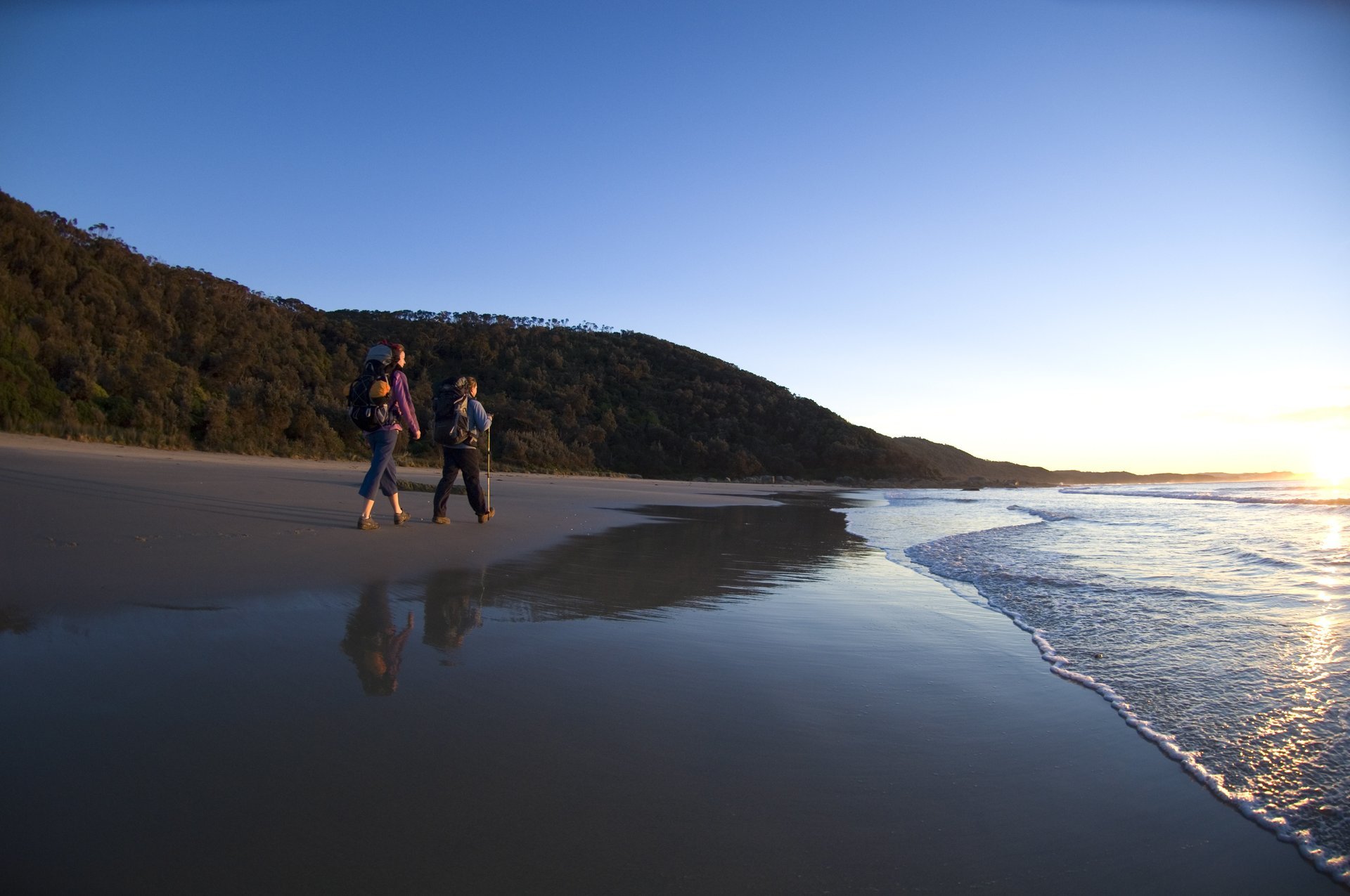
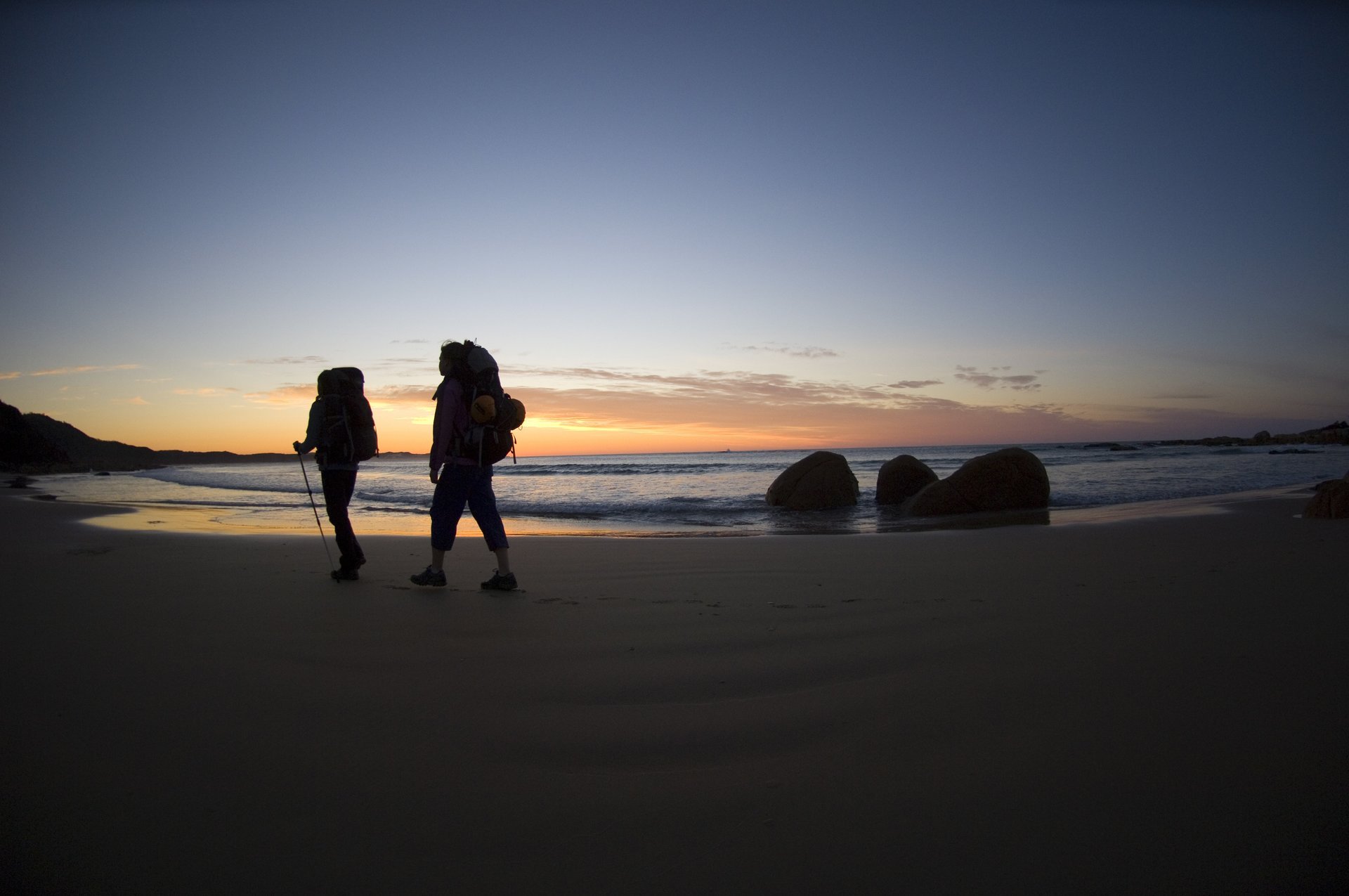
Further south, Wilsons Promontory Southern Circuit is Victoria’s most popular multi-day bushwalk. The 59 kilometre trail weaves its way around one of Australia’s most loved National Parks – from Mount Oberon to the southernmost light station of mainland Australia (where visitors can stay), through Tidal River and onto Oberon Bay. Rainforest, beaches, heathlands and coastal tea-trees make for picturesque terrain.
Wilsons Promontory National Park
Gippsland VIC 3960, Australia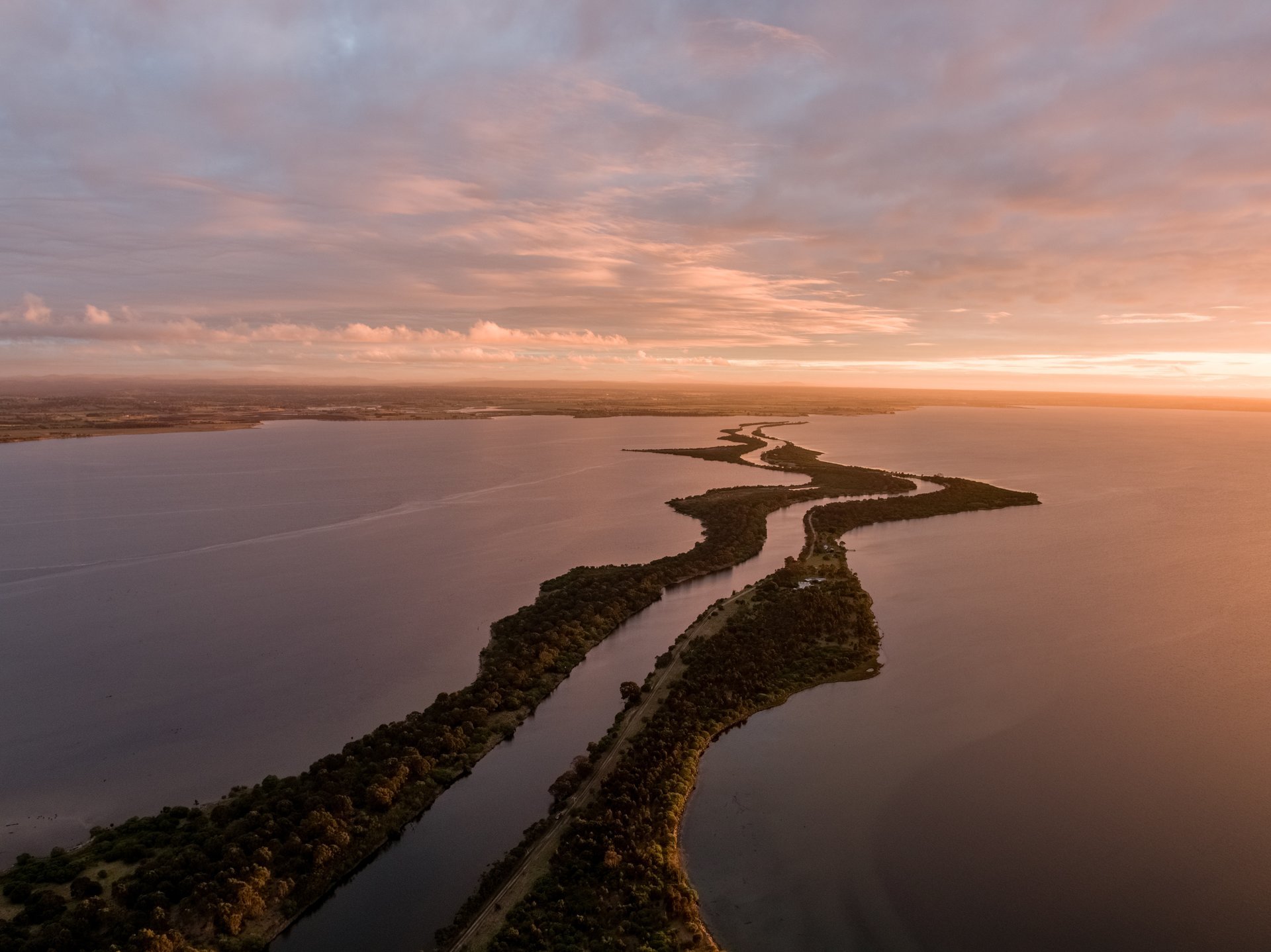
The Mitchell River Walking Track is a 22 kilometre trail from Angusvale to Echo Bend Caravan Park and passes through the Den of Nargun, a place of great cultural significance to the local Gunai Kurnai people. During the Australian Adventure Festival (21-23 October, 2016) competitors run the length of this trail in the flagship Half Marathon event.
Mitchell River Walking Track
Mitchell Riv Walking Trak, Bairnsdale VIC 3875, AustraliaTwo hours east of Melbourne, the Grand Strzelecki Track enables hikers to venture through the Strzelecki Ranges, home to the tallest flowering plants and hardwood trees on earth. There are a number of loop walks that take one to two days to complete ranging from 18 to 25 kilometres in length. Alternatively, the loops can become a continuous circuit of three to five days, with Mountain Ash forests, a variety of short rainforest walks, waterfalls and picnic areas.
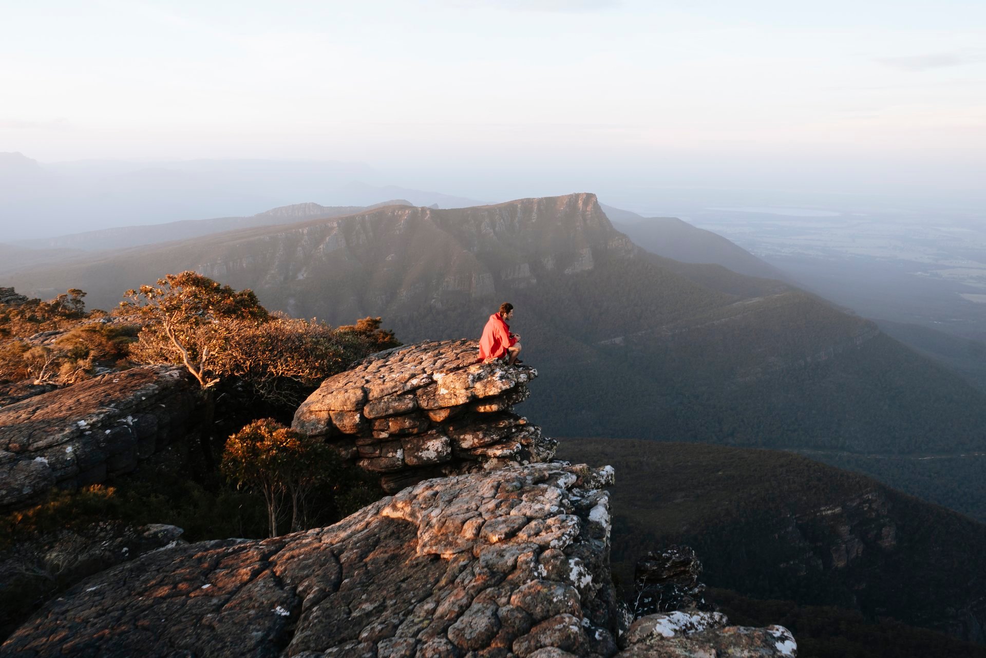
Grampians
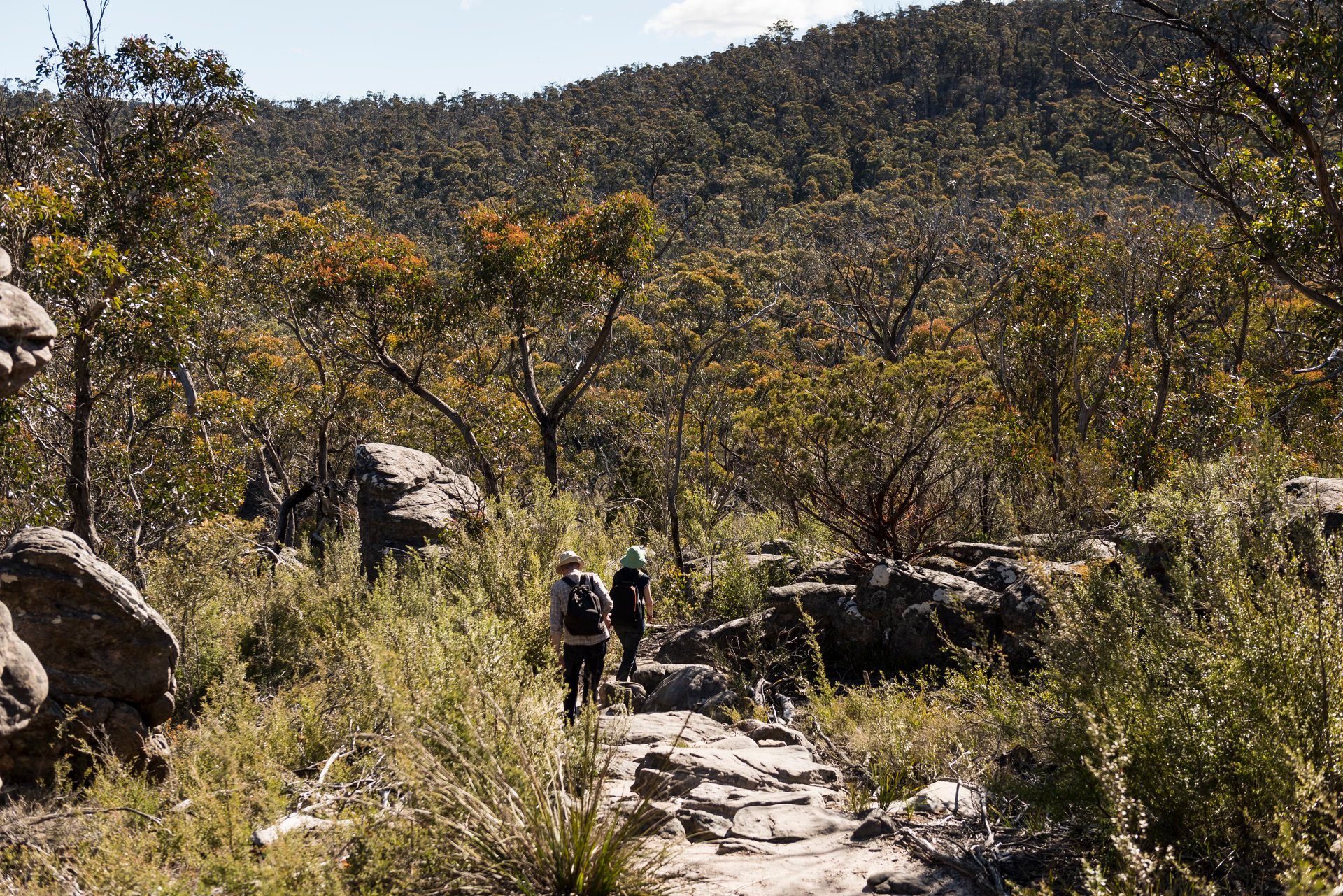
The first stage of the Grampians Peaks Trail is now complete enabling hikers to venture through some of the Grampians’ most popular areas. Highlights include the ancient rock features of the Grand Canyon, views from the Pinnacle Lookout and the spectacular view of mountain peaks from the top of Mt Rosea.
Mount Rosea Track
Mt Rosea Track, Bellfield VIC 3381, AustraliaThis is a one-way three day/two night loop walk from Halls Gap to Borough Huts and back, covering a total of 33 kilometres. Once complete, the entire Grampians Peaks Trail will be a 144 kilometre, 13 day, 12 night (one-way) walk, rich in Aboriginal culture. The journey will provide an insight into the Jardwadjali and Djab Wurrung people who have lived in these ranges they have called Gariwerd for thousands of years.
Hiking Tour Guides are available through Grampians Peaks Walking Company while those after a little luxury can opt for Royal Mail Hotel’s luxury package which incorporates hiking with Grampians Eco Tours.
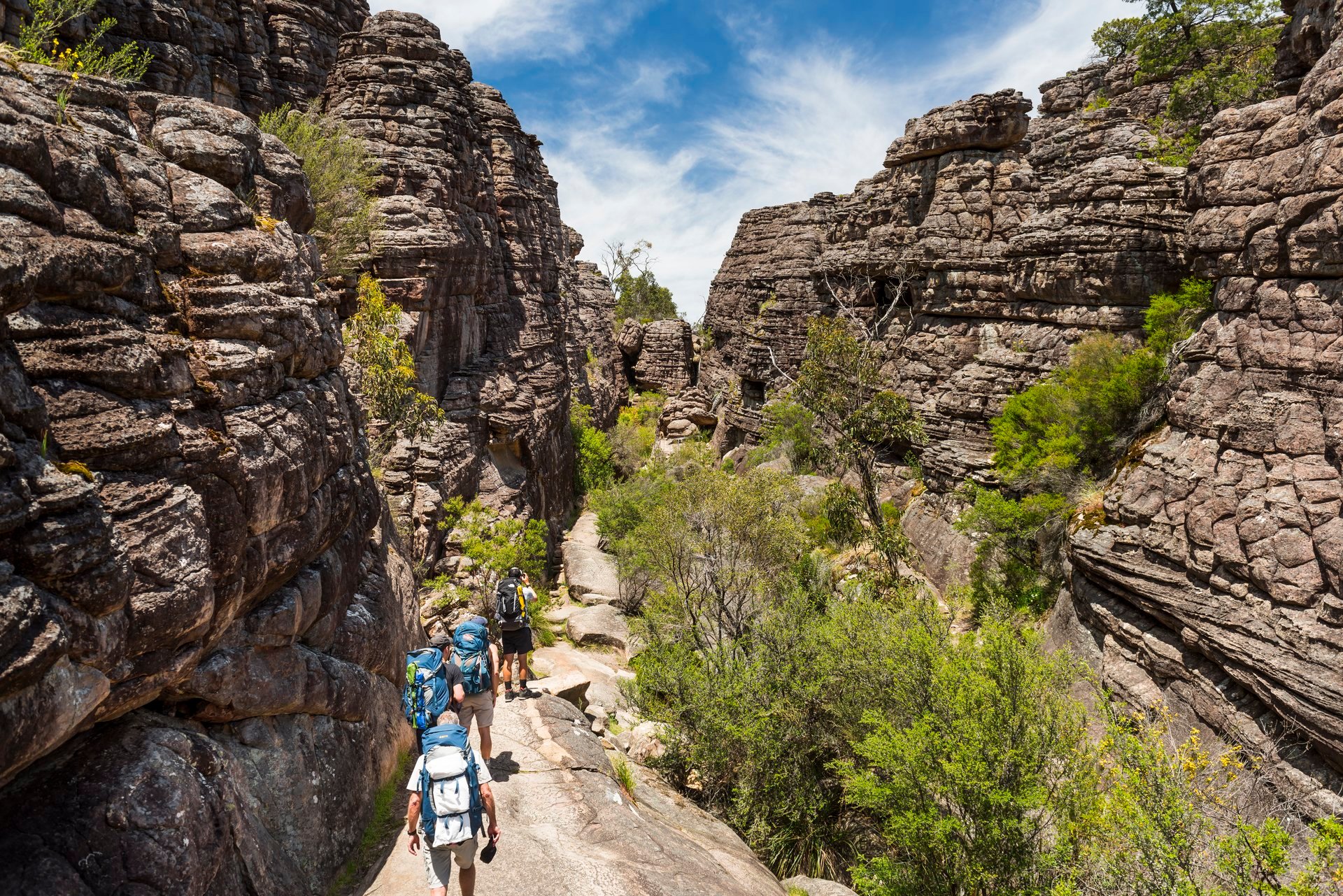
Elsewhere in the Grampians, the two kilometre hike to The Pinnacle rewards walkers with spectacular views, passing Grand Canyon and Silent Street on the way.

The 9.6 kilometre Wonderland Loop takes walkers from Halls Gap to Venus Baths, Splitters Falls and onto Grand Canyon, Silent Street and Pinnacle Lookout. The 2.4 kilometre Piccaninny track, near Dunkeld, will reopen following an upgrade in September 2016 and is a great option for families while Hollow Mountain is a 2.2 kilometre climb with views overlooking Mount Stapylton and the Wimmera plains.
Pinnacle Lookout
Northern- Not accessible via Young Street, Grampians Rd, Halls Gap VIC 3381, AustraliaGoldfields
In central Victoria, a network of tracks and trails enable hikers to journey through ancient forests, connecting the region’s historic towns. The 210 kilometre Goldfields Track follows the old miners trail from Ballarat to Bendigo and the newly opened O’Keefe Rail Trail takes hikers the 50 kilometres from Bendigo to Heathcote. Two new trails are set to open later in 2016, including a 17 kilometre track that will connect Castlemaine and Maldon as well as a new Ballarat to Maryborough Heritage Trail.
Goldfields Track start
303/313 Peel St N, Ballarat East VIC 3350, AustraliaAn hour’s drive west of Ballarat, in the Pyrenees, the 21 kilometre Beeripmo Walk is a hidden gem for hikers. The walk winds through the state forest and Mt Buangor State Park and takes two days to complete, with the option to camp at the Beeripmo Campground on the way. This trail offers a genuine bush-walking experience with cool fern gullies and alpine plateaus, and a night spent surrounded by the smell of eucalyptus and the sound of the Australian bush.
Beeripmo Walk
Beeripmo Walk, Raglan VIC 3373, AustraliaHigh Country
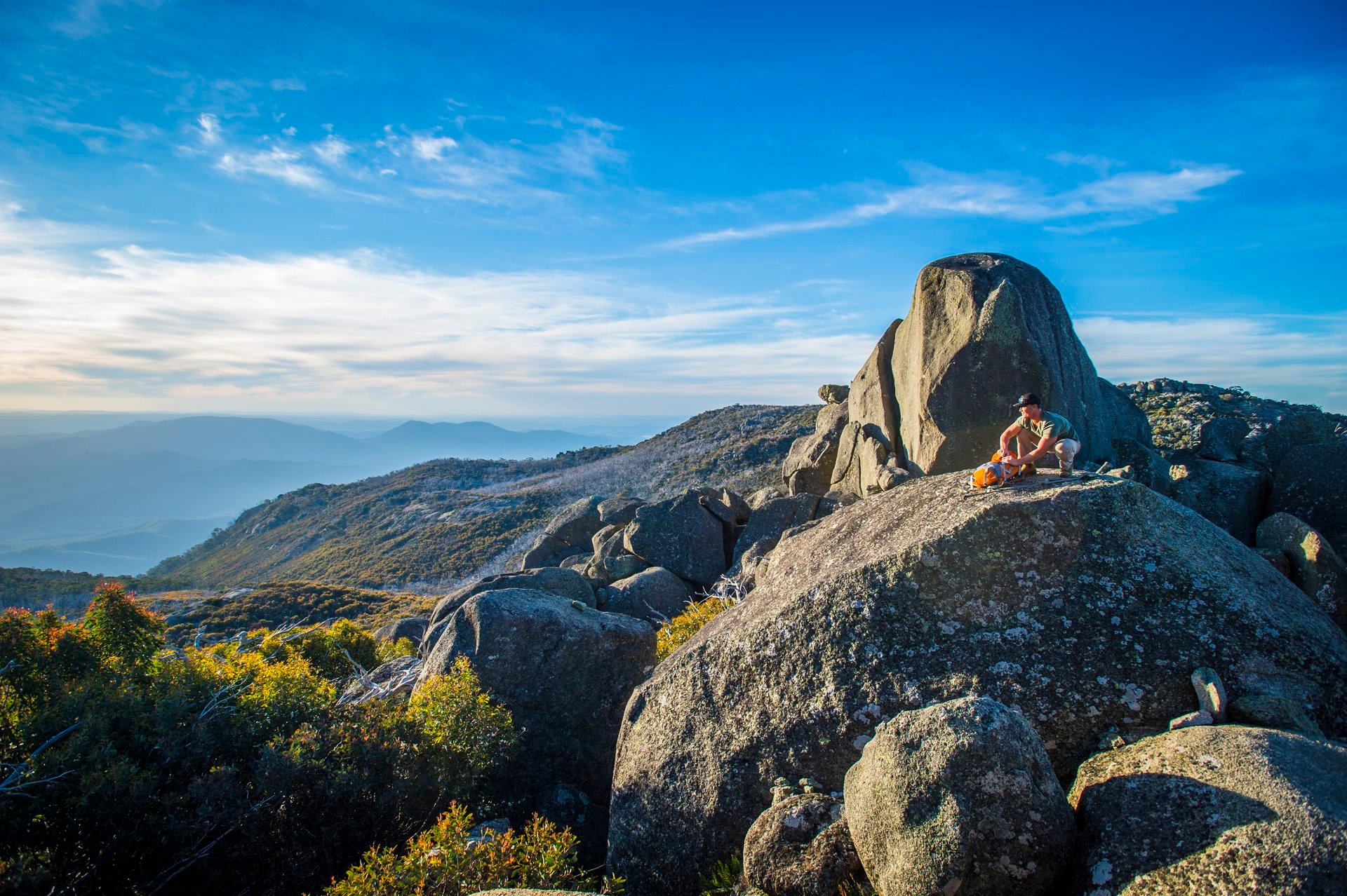
The trails of the 7 Peaks Run, taking in Mt Baw Baw, Mt Buller, Mt Buffalo, Dinner Plain, Mt Hotham, Falls Creek and Lake Mountain, make for a rewarding hike. The spectacular mountain trails are graded and marked Green (less than 5 kilometres, moderate easy terrain), Blue (5-10 kilometres, moderately challenging terrain) and Black (10 – 15 kilometres, difficult terrain).
Mount Baw Baw Summit
32 Currawong Rd, Baw Baw Village VIC 3833, AustraliaOffering an abridged taste of the epic 650 kilometre Australian Alpine Walking Track, the 40 kilometre Great Walhalla Alpine Trail links the historic township of Walhalla to the pristine snowgum environs of the Baw Baw National Park. Hikers can choose a ‘downhill’ or ‘uphill’ end-to-end itinerary, enjoying a two-day journey through alpine plains. Private tours are available, starting at Mt Baw Baw Resort and finishing at Walhalla’s Star Hotel.
The pristine sub-alpine Mount Buffalo National Park is home to more than 90 kilometres of trails ranging from one to 18 kilometres in length. Most are well defined and signposted, making it easy to take a self-guided hike through the park. Walkers can enjoy varied scenery, sublime vistas and carpets of wildflowers from spring to autumn.
Mount Buffalo National Park
Mount Buffalo Rd, Mount Buffalo VIC 3740, AustraliaMornington Peninsula
The 100 kilometre Mornington Peninsula Walk links four established trails along the state’s southern peninsula. The triangular route takes hikers through the historic fort at Point Nepean, foreshore townships, Arthurs Seat, and Cape Schanck and its lighthouse. The terrain ranges from ferny glens to cliff tops, coastal tea-tree forests and golden-sand beaches and the walk can be broken into shorter hikes, or enjoyed in one go.
Mornington Peninsula National Park
Cape Schanck Rd, Cape Schanck VIC 3939, AustraliaGreat Ocean Road
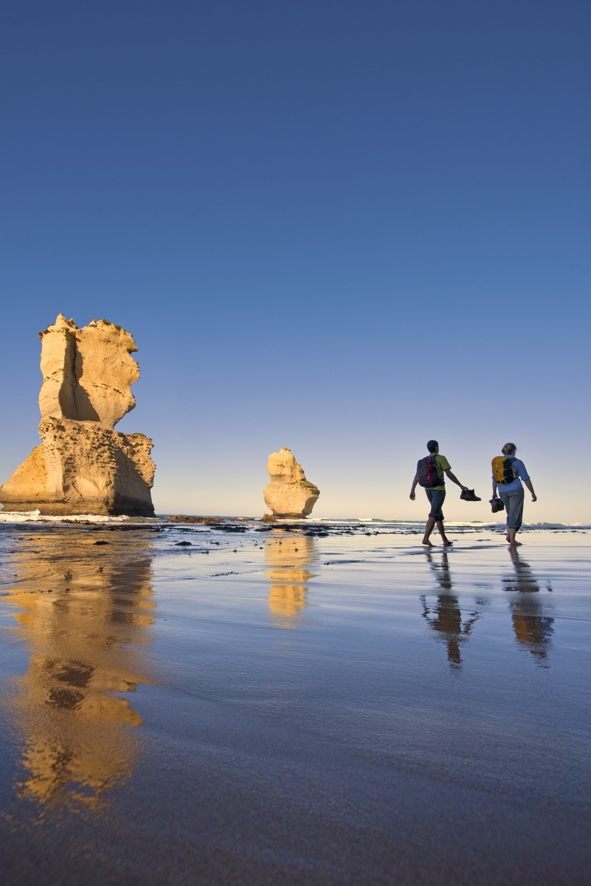
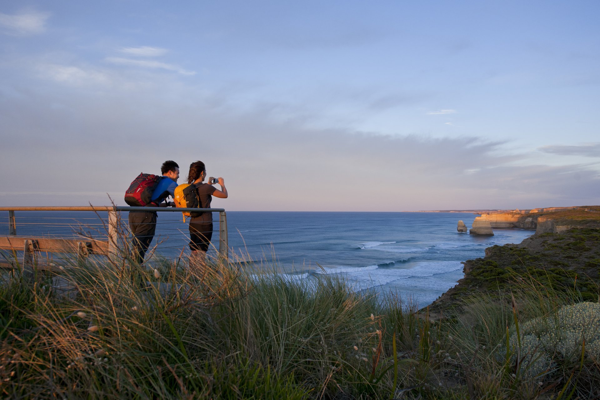
The Great Ocean Walk is the state’s premier multi-day bushwalking experience. This 100 kilometre iconic walk stretches along the state’s south-western coastline from Apollo Bay to the Twelve Apostles. The trail can be broken into short works or day hikes, or experienced in its entirety over eight-days and seven-nights.
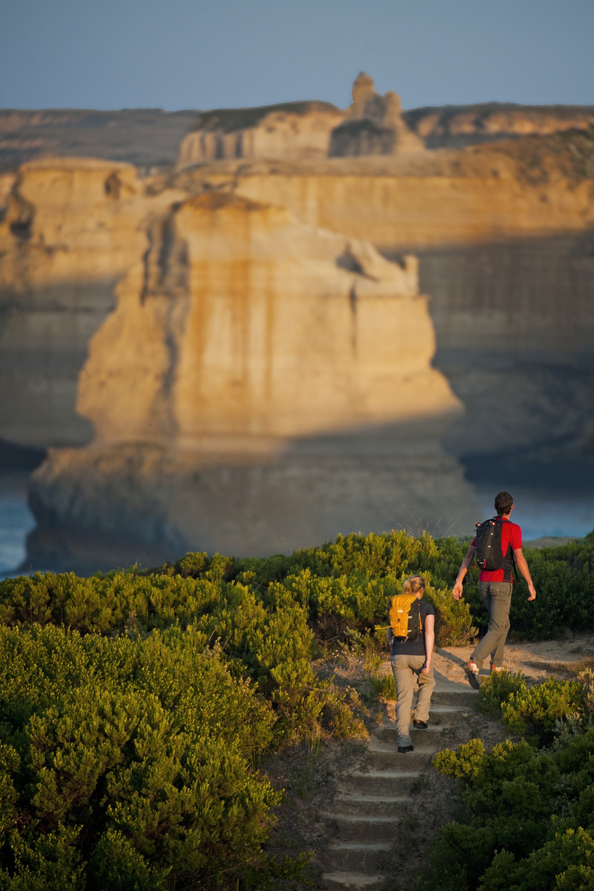
The Twelve Apostles Lodge Walk offers a three-night, four-day guided experience along the western half of the Great Ocean Walk. The experience includes transfers to and from Melbourne, eco-lodge accommodation, gourmet meals, snacks and walking gear and finishes with a helicopter flight over the Twelve Apostles.
Great Ocean Walk
100 Great Ocean Rd, Apollo Bay VIC 3233, AustraliaThe 44 kilometre Surf Coast Walk runs from Point Impossible to Fairhaven along the Great Ocean Road. The trail passes through renowned beaches near Australia’s surf capital, Torquay, including the iconic Bells Beach. With 12 easy to access trail heads, it can be enjoyed as a day walk or multi-day experience. Along the way, visitors can learn about the Aboriginal way of life with he Koorie Cultural Walk, where interpretive signs provide information.
Surf Coast Walks
3 Camp Rd, Anglesea VIC 3230, AustraliaThe Great South West Walk can be broken into two-hour loop walks or day walks, while the intrepid can walk the entire 250 kilometre loop that begins and ends in Portland in South West Victoria. From forest to beaches and the banks of the Glenelg River, the trail takes in a diverse landscape and boasts swimming holes, sand dunes, blow holes and seal colonies along the way.
Great South West Walk
Bentinck Street, Portland VIC 3305, AustraliaGeelong and the Bellarine
From coastal paths to rugged bush trails, there is an impressive selection of walks and hikes in Geelong and The Bellarine. Walkers can take a beachside hike from Point Lonsdale to the mouth of the Barwon River, or walk the one hour round trip from Ocean Grove to Barwon Heads along the sand or via the inland track. Views overlooking The Rip and Point Nepean can be enjoyed on the six kilometre coastal walk from Queenscliff to Point Lonsdale.
Point Lonsdale
Point Lonsdale VIC 3225, AustraliaEdwards Point Nature Conservation Reserve is home to multiple walking trails, abundant wildlife, pristine sandy beaches and cool coastal woodlands. The mostly flat, 35 kilometre Bellarine Rail Trail winds from South Geelong to Queenscliff and is an excellent track for walkers and riders. Nearer Geelong, there are bush trails in the You Yang Ranges and river strolls around the Barwon River.
Bellarine Rail Trail
Bellarine Rail Trail, Moolap VIC 3224, AustraliaMurray
Hiking in the Koondrook Red Gum Forest Walk is interspersed with DELWP Forest Notes and interpretive information boards, enabling hikers to learn about the landscape and its cultural significance. Two half day walks provide the opportunity to see a variety of vegetation, wetlands, wildlife and birdlife on Gunbower Island. The walks are easily accessed on the edge of the Koondrook township.
Gunbower Island
Gunbower Island, Cohuna VIC 3568, AustraliaSurrounded by hills, Albury offers a variety of trails for both the beginner and intermediate hike. The five kilometre Wagirra and Yindyamarra Sculpture Trails feature eleven Indigenous sculptures and follows the Murray River to Wonga Wetlands.
Albury–Wodonga
Albury–Wodonga, AustraliaHave Story To Share?
Blog with Trip.Social

Reach new audiences and maximize your potential.